
MCNY Blog: New York Stories
Iconic photos of a changing city, and commentary on our Collections & Exhibitions from the crew at MCNY.org
From Expressway to Contemplative Oasis: The Elevated West Side Highway
When racing in a cab down West Street trying to make it in time for a meeting, how many people think back just a few decades when an elevated expressway ran down the western edge of the city from the Henry Hudson Expressway to Battery Park? Of course, I am speaking of the old Elevated West Side Highway, a Robert Moses project initiated just as car culture was coming into its own. The first section of the highway opened to the public in 1930, but the entire project was not realized until 1951. A precursor to the expressway era that would follow, the West Side Highway was praised early on by The New York Times as it would “afford immediate and measurable relief to traffic congestion on Riverside Drive” and allow motorists to drive all the way from downtown “nearly to Poughkeepsie without having to stop for a traffic light or slow up for an intersection.”
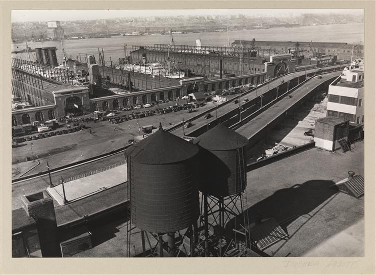
Berenice Abbott, West Side Express Highway and Piers 95-98 (Taken from 619 West 54th Street), November 10, 1977. Museum of the City of New York, 49.282.167
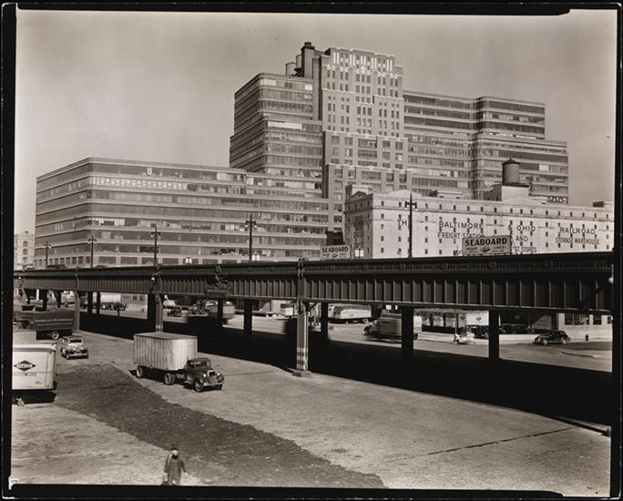
Berenice Abbott, Starrett-Lehigh Building II (601 West 26th Street between Eleventh and Twelfth Avenues. The West Side Highway is in front of the building.) March 1, 1938. Museum of the City of New York, 89.2.1.264
The highway was constructed with beautiful Art Deco ornamentation, reflective of its era, but soon after came the realization that it was too difficult for tractor tailors to navigate: the on-ramps were too narrow and the turns were often too tight. The roadway and its structural underpinnings were not properly maintained and on December 15, 1973 a section of the highway collapsed under the weight of a dump truck carrying asphalt.
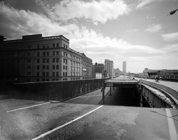
Edmund V. Gillon, [West Side Elevated Highway], ca. 1975. Museum of the City of New York, 2013.3.2.700

Jan Staller, Billboards seen from the West Side Highway, 1978. Museum of the City of New York, 2015.5.2
Jan Staller, Ramp at the Passenger Ship Terminal on the Hudson River, seen from the West Side Highway, 1978. Museum of the City of New York, 2015.5.12

Jan Staller, West Side Highway Ramp at 23rd Street, 1978. Museum of the City of New York, 2015.5.27
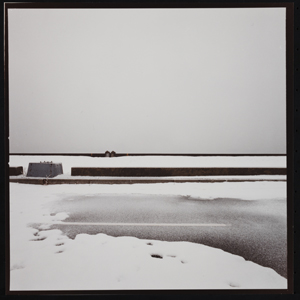
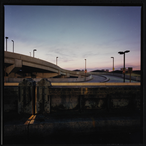
Jan Staller, West Side Highway Dusted with Snow, 1977. Museum of the City of New York, 2015.5.28

Jan Staller, Fire alarm box at 11th Avenue, 1978, 2015.5.3
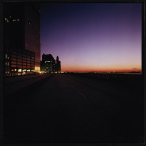
As he became more serious about make pictures of the highway he brought along a Hasselblad Superwide, color negative film and a small tripod. Staller went on to say, “I found that there was a very kind of contemplative or spiritual quality to the twilight in Manhattan…. I was going to find some kind of approximation of the natural world. So after the sun started getting low in the sky, the city started to quiet down…. The peace was very seductive.”
Jan Staller, Pier 32 near Canal Street, seen from the West Side Highway, 1978. Museum of the City of New York, 2015.5.3
A sense of place is at the core of this body of work, and the effect of light is a key ingredient to its success. The mixed light of sunset in combination with the sodium vapor and incandescent lighting of the city have a remarkable effect on the finished prints. Many of the images were created using time exposures – sometimes up to five minutes long. The results are lush, saturated images of the city that belie the stark setting.

Jan Staller, World Trade Center, seen from the West Side Highway, 1978. Museum of the City of New York, 2015.5.1
Today, the elevated roadway is gone and cars rip up and down West Street past joggers and tourists at the water’s edge. On the right evenings it is still possible to see something of the glowing twilight Staller was looking for about thirty years ago. To see the rest of his photographs in the Museum’s collection, visit the Collections portal.
Museum of the City of New York

