
MCNY Blog: New York Stories
Iconic photos of a changing city, and commentary on our Collections & Exhibitions from the crew at MCNY.org
John Bute Holmes, surveyor and polygamist.
To quote my colleague Susannah in her fascinating post from a few weeks ago, “Hints about long vanished and forgotten aspects of New York surround us if we know where to look.” This is no recent concept, and was in fact intriguing to City Surveyor John Bute Holmes (ca.1820-1887) as far back as the 1860s, continuing up to his death in the 1880s. Holmes created maps that showed dualities – the city as it had been and the city as it was – and he himself led a life of multiplicities, leading to a certain fogginess surrounding basic biographical details. You’ll understand why he attempted to remain rather elusive later in the post.
Holmes claimed to have been born on the Island of Mauritus in the Indian Ocean in 1822 (an article published shortly after his death states he was just shy of 69 years old in 1887, implying his birth year would have beem 1818); have moved to Cork, Ireland, at the age of eight; and, according to him, he left Cork to emigrate to the United States in 1838, 1841, or maybe 1842, depending on the particular situation he was trying to talk himself out of. He worked as a surveyor, moving back and forth between Cork, London, and Owego, New York, until 1848, and then resided in Brooklyn and Staten Island until 1856. His exact whereabouts between 1856 and 1873 are somewhat vague (perhaps as a result of the fact he was hiding from the wife he had left destitute), though he is assumed to have been in or near New York City based upon his City Surveyor position. He eventually landed on a farm in New Jersey and died there in 1887.
It was while conducting the assessment of maps in the J. Clarence Davies Collection, as part of a National Endowment for the Humanities grant project, that I first came across a number of maps executed by Holmes. These maps featured farm boundaries, property lines, streets, and lanes from the 18th century or even earlier, overlaid with the existing street grid from the second half of the 19th century, when Holmes was conducting his survey. The map below of the East and West De Lancey Farms is a perfect example, showing De Lancey (now condensed to “Delancey”) Street cutting right through the middle of the original farm property, running east to west.

John Bute Holmes (ca.1820-1887). Map of the East and West De Lancey Farms. Museum of the City of New York. 29.100.2902.
(Click on any of the maps in this post to be taken to the high resolution image in the Collections Portal, where you have the capability to zoom in on the finest detail.)
The maps are extremely helpful when trying to identify streets whose names have changed. The map of the Bayard Farm, shows a number of such streets with their previous names and the names they had at the time of Holmes’s surveys.

John Bute Holmes (ca. 1820-1887) and Th. Casimir Goerck (d. 1798). Map of the Bayard Farm. Museum of the City of New York, 29.100.2811.
The Map of Kip’s Bay Farm closely follows the boundaries of today’s neighborhood of Kips Bay. You’ll see in this map that some streets didn’t just change names, but actually changed in layout, as well.

John Bute Holmes (ca.1820-1887). Map of the Kip’s Bay Farm. Museum of the City of New York. 29.100.2823.
The Museum holds several more maps from this series, referred to as the “John Bute Holmes Conveyancing Maps,” published by M. (Matthew) Dripps, including the key to how they all fit together. While the entire series hasn’t yet been digitized, you can view a number of them on the Collections Portal by clicking here.
The more time I spent with the Holmes maps, the more I began to wonder about the man behind them. I always wonder what used to be here and how did this street get its name as I walk down New York City’s streets. I envisioned John Bute Holmes doing the same thing, nearly 150 years ago. Was John Bute Holmes a kindred spirit? After a little research, however, I began to feel amazed and even baffled by Mr. Holmes.
While I’ve had trouble unraveling the exact chronology, John Bute Holmes was married to at least four women during his life, sued by a fifth for “impeaching her chastity” as a result of “breach of promise of marriage,” known to have lived with another “as husband and wife,” and was reputed to have killed a policeman with whose wife he was involved. Some of these relationships appear to have overlapped, and most of the wives were unaware of the previous wives, even when the unions had been dissolved legally. It wasn’t until Holmes’s death in 1887 that the four legal (or at least to their knowledge) wives came face to face in an attempt to claim their inheritance. The dual nature of Holmes’s maps strangely seems to reflect the duplicitous nature of Holmes’s life. Did Holmes get so entranced by his maps that he felt he was living in multiple time periods, and therefor entitled to multiple wives?
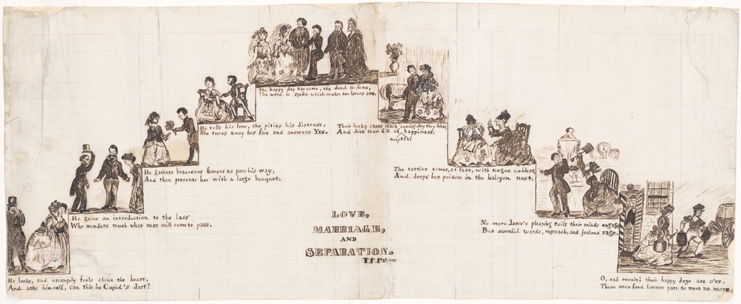
F. (Fanny) Palmer (1812-1876). Love, Marriage and Separation. Museum of the City of New York. X2012.5.34.
A few different accounts in the New York Times attempt to sort it out, and briefly, this is what I’ve come away with:
- Wife # 1: Anna Maria Clear, married Cork Ireland 1838. Holmes left her in 1856, Anna filed for divorce in 1875. One daughter.
- Living as husband and wife: Ida Kerr, dates unknown.
- Wife #2: Hannah Wright Williamson (also his half-sister), marriage date unknown. Three children.
- Sued for breach of marriage promise: May Chamberlayne, 1874.
- Wife#3: Mary Sullivan Browning, marriage date unknown. One son.
- Wife#4: Katie Meadows, married ca. 1886.
The two women who seemed to feel they had the strongest claim to Holmes’s inheritance were first wife Anna, who was 64 at the time of his death, and final wife, Katie, who was just 19. Just like Holmes’s maps represented the city in two time periods, these two women represented Holmes as he was once, and Holmes as he was in the present day. Click here to read the May 27, 1887 New York Times article for more details on the fight amongst the wives and their children.
Museum of the City of New York

